
Transforming Drone Data into Actionable Insights
Drones have made it easy to collect a flood of aerial data - the hard part is turning that raw data into useful information. Industry experts note that while drones are great at gathering images and measurements, “the bigger challenge is actually how to use all that data for best effect”. Asset managers and owners often find themselves overwhelmed with hundreds of photos, point clouds, and maps. In fact, many organizations struggle with data overload from drone surveys, lacking the specialized skills and tools to interpret the information. Simply put, raw data alone isn’t enough - it must be processed into accurate maps, models, and reports that deliver actionable insights to decision-makers
Transforming Drone Data into Actionable Insights
At True Datum Aerial, we handle the complex post-processing and analysis so you don’t have to. Our team transforms raw drone imagery and sensor data into decision-ready deliverables - precise 2D maps, 3D models, and technical drawings that you can drop straight into your CAD, BIM, or GIS workflows. We combine advanced photogrammetry, surveying expertise, and civil engineering know-how to ensure that every output is accurate, georeferenced, and tailored to your project needs. The result? You get clear, reliable information about your site or assets without the headache of processing data in-house. We take pride in fast turnaround (often next-day for standard mapping jobs) and rigorous quality control at every step, providing full transparency with QA reports and even raw images on request.
Our Post-Processing & Drafting Capabilities
We offer a comprehensive suite of drone data processing, modeling, and drafting services to turn aerial data into meaningful results:

Orthomosaic Aerial Maps:
We stitch together high-resolution drone photos to create clean, georeferenced orthomosaic maps - up-to-date overhead images of your site, corrected for true scale. These maps provide an accurate base for measurements, inspections, and progress tracking, giving you a detailed bird’s-eye view of your assets.

3D Point Clouds & Terrain Models:
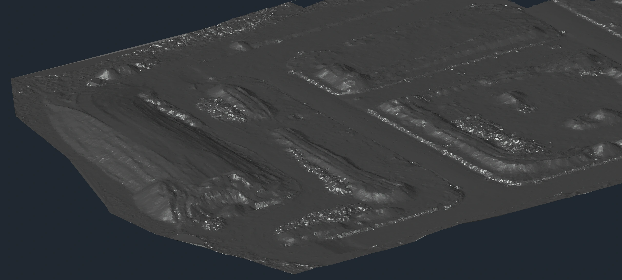
Using photogrammetry processing, we generate dense 3D point clouds and digital surface/terrain models. Every pixel from the drone is transformed into a point with real-world X, Y, Z coordinates, capturing your site’s features in three dimensions. We can produce contour lines and elevation models from this data, so you have an accurate representation of the ground terrain and structures – essential for engineering design and cut/fill analysis.

Stockpile & Earthworks Volume Calculations:
For mining, quarrying, or construction earthworks, we turn survey data into precise cut and fill volume estimates. Our processing workflows calculate stockpile volumes, excavation quantities, and fill levels across your site. We provide easy-to-read volume reports along with color-coded maps (for example, cut/fill heatmaps) so you can visually identify high and low areas and trust the numbers for inventory or billing.

Corridor Modeling & Cross‑Sections:
We support linear infrastructure projects (roads, rail corridors, drainage channels, etc.) by creating detailed corridor models. From the drone data, we extract long-section profiles and cross-sections at specified intervals or critical locations. This allows engineers to see ground profiles and cross‑sectional views along a route, helping with design validation, drainage analysis, and quantity take-offs for planning and pricing.

As-Built Plans & Design Verification:
Our drafting team can produce as-built drawings that document what’s actually on the ground, based on the drone survey. By comparing the as-built condition to the original design, we help you verify that construction work is to specification (or pinpoint where it deviates). These plans provide a clear overlay of “design vs. as-built” so owners and contractors can catch any issues and update records.

CAD Drafting & Plan Production:
Going beyond raw data, we convert survey results into polished engineering drawings and CAD files. Whether you need a topographic site plan, a set-out plan for earthworks, contour maps, or elevation views, we have you covered. We deliver files in formats like DWG, DXF, or Shapefile, complete with the details and annotations you require. By receiving ready-to-use plans, your team can plug the data directly into design software or reports without extra conversion work.

Feasibility Grading & Design Support:
Planning a new development or infrastructure upgrade? We use the drone-derived terrain models to assist with feasibility studies and preliminary design. Our experts can help conceptualize grading plans for example, proposing finished ground levels, drainage slopes, or building pad elevations that work with the existing topography. By evaluating “what-if” scenarios digitally, you save time and make informed decisions in the early stages of a project.

Data Clean‑Up & Format Conversion:
Already have drone data from an in-house team or another source, but need help making sense of it? We offer data clean-up and conversion services to refine and reformat client-captured datasets. This includes filtering noisy point clouds, aligning data to the right coordinate system, and converting files between platforms. In short, we make sure your data is usable and compatible with the tools and systems you rely on.
Why Choose True Datum Aerial?
Choosing True Datum Aerial means you’re entrusting your data to a team that understands both the technology and the end-use of the outputs. Our background in engineering, design and data processing ensures that the deliverables we produce aren’t just technically correct - they’re actually practical for your needs. We focus on the outcomes that matter to you: volumes that balance, contours that tie in with existing surveys, maps that align with your site grid, and drawings that meet engineering standards.